Water
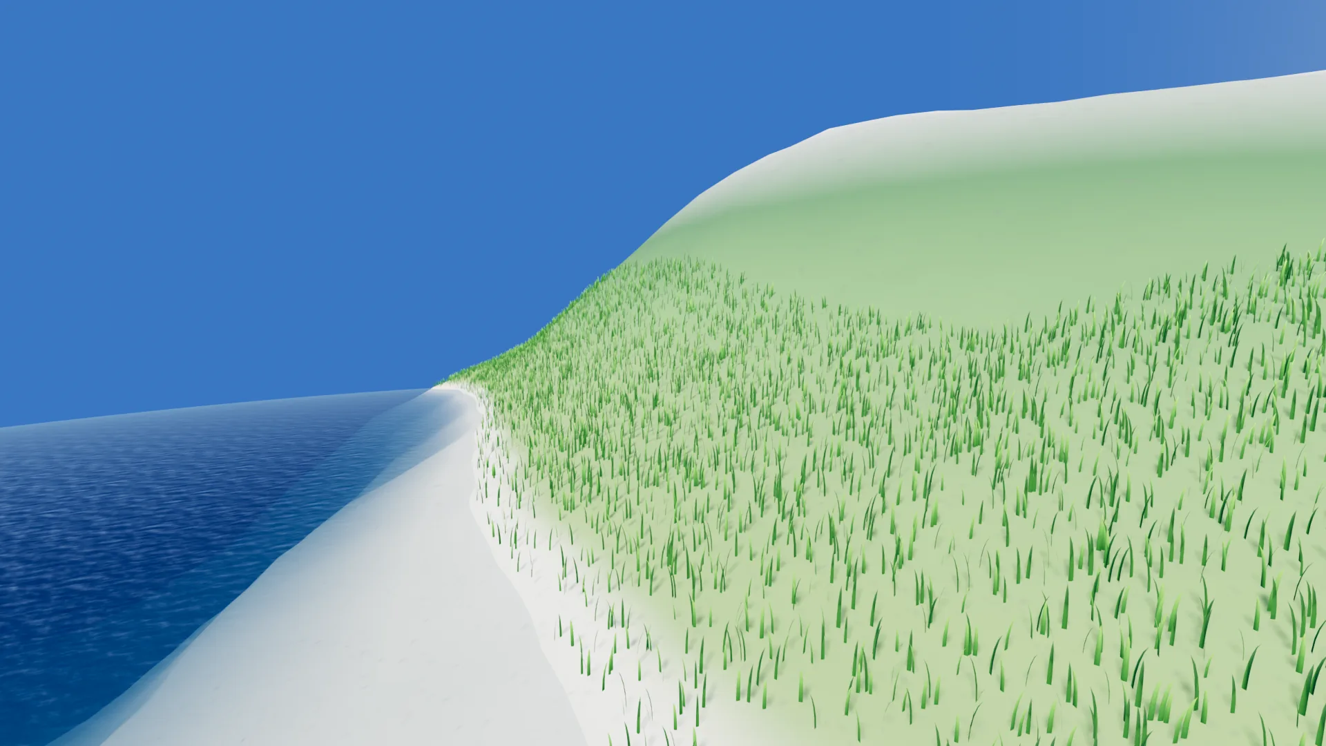
Every planet can have an ocean. It costs no geometry: there is no water mesh, no tessellated sea surface, no extra chunks. A coarse proxy sphere spawns fragments and the shader ray-intersects the mathematical sea-level sphere per pixel, so the surface is perfectly smooth at any distance — from orbit down to standing in the surf.
Note
Water lives on the builder, not on the Celestial node.
If you go looking for a water_enabled checkbox on the planet you won't find
it — open the Builder resource in the inspector. The reason is that the
water level is a terrain parameter: it decides the land/sea split and the
shore colouring the terrain itself is baked with, so it has to travel with the
terrain. Clear the builder and the water goes with it.
Properties (on CesBuilder, inherited by every builder)
| Property | Default | What it does |
|---|---|---|
water_enabled |
true |
Draw the ocean. Off also hides the appearance knobs below in the inspector (their values are kept). |
water_height |
0.549 |
Sea level as a normalized terrain height, 0–1. |
water_deep_color |
(0.05, 0.22, 0.42) |
Body colour far from shore. |
water_shallow_color |
(0.20, 0.55, 0.70) |
Body colour near shore. The two are blended by water depth, exponentially. |
water_wave_strength |
0.55 |
How strongly the wave normal map perturbs the surface. 0 = a flat mirror. |
water_wave_scale |
0.15 |
Wave tiling frequency. |
water_wave_speed |
0.04 |
Wave scroll speed. |
water_underwater_color |
(0.04, 0.16, 0.28) |
Fog tint applied when the camera is below the surface. |
water_underwater_density |
0.02 |
Beer–Lambert fog density, per world unit of water column. |
Heights are normalized: what 0.549 means
Terrain height is a number h from 0 to 1, not a radius and not metres.
0.5 is the baseline — sea-level-ish, the middle of the range. Everything, the
water level included, is expressed on that scale.
Two knobs turn h into world units:
height_scaleis how tall the terrain is, as a fraction of the radius. The whole 0→1 height range spans2.4 × height_scale × radius. With the GPU noise builder's default (0.0585) on a 1000-unit planet, that is a 140-unit band for every mountain and trench to live in. Set it to0and you get a perfect sphere; double it and every mountain doubles. It is the master relief knob.water_heightis simply where in that band you fill with water. Put the samehinto the formula and you get the sea-level radius:
At the defaults (water_height = 0.549, height_scale = 0.0585, radius 1000) the
sea sits at a radius of about 1007 — a little above the baseline, which is why
the stock planet has oceans with continents poking out. Lower water_height to
drain them and expose more land; raise it to flood.
Because height_scale is in the formula, the same water_height means a different
radius on a different builder: the CPU noise example uses height_scale = 0.25, so
its terrain — and its sea — sit much further out.
Warning
Editing water_height reshades the whole planet, not just the sphere:
the terrain's own shore colouring is baked against it. It is a live edit — you
see it immediately — but it is not free like a colour tweak, so don't drive it
from _process.
Custom GPU builders can read the same value in their .glsl as
CELS_WATER_HEIGHT, which is how you keep your shader's own beach line in
agreement with where the water actually is. See
custom_terrain_gpu.md.
How it is rendered
addons/celestialsim/water_surface.gdshader, on a low-segment SphereMesh proxy
inflated 2% past the true sea-level sphere so its faceted silhouette always
over-covers the smooth one (rays that miss the analytic sphere are discarded).
The shader renders back faces only and occludes manually against the depth
texture of the already-drawn terrain, which is also where water depth — and
therefore the shallow-to-deep colour blend and the shoreline foam — comes from.
On top of that: triplanar wave normals, a Schlick fresnel rim reflecting an
analytic sky gradient, and a sun glint taken from the scene's
DirectionalLight3D. Below the surface, a Beer–Lambert fog tints everything by
how much water the camera is looking through.
The ocean shading is a port of Sebastian Lague's MIT-licensed planetary ocean; the provenance is spelled out at the top of the shader file.
Turning it off
Uncheck water_enabled on the builder. The proxy sphere is not drawn at all and
the appearance knobs disappear from the inspector until you turn it back on. The
terrain still uses water_height for its land/sea colouring, so an "airless"
planet usually wants water_enabled = false and a custom terrain_color that
doesn't paint a seabed.
Note
On mobile the water's depth-texture read and overdraw are the expensive part of the frame — if you are chasing 60 fps on a phone, this is the first thing to switch off and measure.